Iceland Intermission
For those of you keeping track, yes, we are several days behind on getting our pics posted. It’s now the summer solstice, 2015, and we are at the end of day 14.
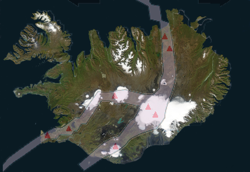
Give the map of Iceland a quarter turn counter-clockwise, and the shape looks like a reindeer with a very large and bumpy sack on its back. The Mid-Atlantic Ridge (a divergent tectonic plate boundary separating the Eurasian and North American Plates) slices through the reindeer’s back leg where Reykjavik is, then jogs and splits the island more or less in half.
(Ridge location in image is approximate, I merged a NASA pic and a GSA diagram, which were probably not done with the same projection.)
In simple terms, the further away from the ridge, the older the rock. The moss-covered Laki deposition rocks from Day 5 are 230 years old, the exposed rock in the Westfjords is probably 3 million years old (still searching for an exact reference) and Iceland’s formation is 15-16 million years ago. The difference in age shows, and is fascinating to see in such an open book fashion.
The ring road circles from Reykjavik around the sack, entering the reindeer at the shoulder and looping back through the midsection, completely slicing away the antlers, head, and front legs. We’re 3/4 the way through our trip, having circumnavigated the ring road counter-clockwise, and are now in the Westfjords, which is effectively the reindeer’s antlers and head.
One excuse for the delay in keeping up with our posting is connectivity. It’s been great around the ring road, the sole exception being a hotel staffed by college students where the internet appeared to be throttled. We’re surmising why :-). The further away from the ring road we get, the more unpredictable it is, especially in small towns. The other excuse is we’ve just got way too many pictures to process.
More coming…

